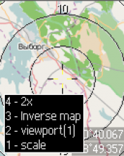
Program Map Mobile Navigator in accordance with the name used for mobile navigation using a different card formats Ozi, GoogleMap and Virtual Earth.This card can be loaded in real time.The program supports Geocaching GameThat allows users to download location of the closest caches.The program is actively developing in her weekly there are new features and services.
Features "MapNav":
Display images and maps of the Earth's surface from sites maps.google.com and vi rtualearth.com with caching and the ability to review later without access to the Internet
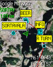
Download waypoints and routes OziExplorer (supports the display of symbols Garmin) from the Internet or file
Display the next three caches geocaching.ru
Auto-recently used the GPS-receiver
The use of the cards attached to the OziExplorer
Sending a SMS with your coordinates and their preparation with the transition to a point
Recording a track with an interval distance
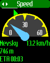
Working with a GPS-receiver for Bluetooth (speed displayCourses, Compass modeAnd the distance, Direction and time of arrival to the selected waypoint)
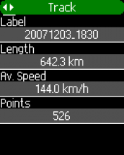
Recording the traveled track, View the profile of the track, Maintaining the track in the file format OziExplorer
Navigating the busiest points or route, indicating the direction and distance to the selected waypoint.

176x208: S60v2
176x220: SE K700, K750
176x220: SE K550, K610, W350, W810, Z710
176x220: SAM D500, E380, E500
208x208: S40v2
240x320: S40v3
240x320: S60v3
240x320: SE K770, K800, S500, T650, W850
240x320: SAM D600, D800, D900
320x240: S60v3
352x416: S60v3
360x640: S60v3
v4.7.0 Download [363.39kb]
176x208: S60v2
176x220: SE K700, K750
176x220: SE K550, K610, W350, W810, Z710
176x220: SAM D500, E380, E500
208x208: S40v2
240x320: S40v3
240x320: S60v3
240x320: SE K770, K800, S500, T650, W850
240x320: SAM D600, D800, D900
320x240: S60v3
352x416: S60v3
360x640: S60v3
v4.7.0 [
Lite]
Download [229.02kb]


 Downloaded By: 505 Users!